Winter Weather Advisory For Cheyenne and Laramie Monday
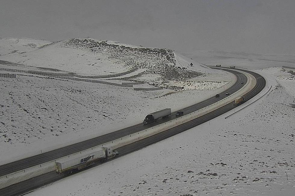
The National Weather Service has issued a Winter Weather Advisory for much of eastern Wyoming, including the cities of Cheyenne and Laramie, in effect from Monday morning through Monday evening. Winter Storm Watch is in effect for the I-80 Summit area between Cheyenne and Laramie.
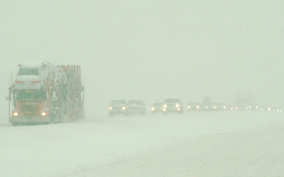
Three to six inches of snow are possible Monday, with higher amounts in the mountains. "Plan on slippery road conditions. Patchy blowing snow could significantly reduce visibility. The hazardous conditions could impact the evening commute," The National Weather said.

Get our free mobile app
URGENT - WINTER WEATHER MESSAGE
National Weather Service Cheyenne WY
211 PM MDT Sun Apr 18 2021

...STRONG COLD FRONT WILL BRING MUCH COLDER TEMPERATURES AND
ACCUMULATING SNOW LATE TONIGHT THROUGH LATE MONDAY...

NEZ020-054-WYZ105>108-110-114-115-117>119-191200-
/O.EXB.KCYS.WW.Y.0029.210419T1500Z-210420T0500Z/
Banner County-Kimball County-Shirley Basin-
Central Laramie Range and Southwest Platte County-
East Platte County-Goshen County-North Snowy Range Foothills-
Snowy Range-Laramie Valley-South Laramie Range Foothills-
Central Laramie County-East Laramie County-
Including the cities of Harrisburg, Kimball, Medicine Bow,
Shirley Basin, Bordeaux, Wheatland, Guernsey, Torrington,
Arlington, Elk Mountain, Centennial, Albany, Laramie, Bosler,
Whitaker, Federal, Horse Creek, Cheyenne, and Pine Bluffs
211 PM MDT Sun Apr 18 2021

...WINTER WEATHER ADVISORY IN EFFECT FROM 9 AM TO 11 PM MDT
MONDAY...

* WHAT...Snow expected. Total snow accumulations of 3 to 6 inches,
  with 6 to 8 inches for the Snowy Range. Winds gusting as high
  as 35 mph.

* WHERE...Southeast Wyoming and portions of South Central Wyoming
  including Arlington, Cheyenne, Kimball, Laramie, Pine Bluffs,
  and Torrington.

* WHEN...From 9 AM to 11 PM MDT Monday.

* IMPACTS...Plan on slippery road conditions. Patchy blowing
  snow could significantly reduce visibility. The hazardous
  conditions could impact the evening commute.

PRECAUTIONARY/PREPAREDNESS ACTIONS...

Slow down and use caution while traveling.

The latest road conditions for the state you are calling from can
be obtained by calling 5 1 1.
URGENT - WINTER WEATHER MESSAGE
National Weather Service Cheyenne WY
211 PM MDT Sun Apr 18 2021

...STRONG COLD FRONT WILL BRING MUCH COLDER TEMPERATURES AND
ACCUMULATING SNOW LATE TONIGHT THROUGH LATE MONDAY...

WYZ116-191200-
/O.CON.KCYS.WS.A.0006.210419T1500Z-210420T0900Z/
South Laramie Range-
Including the cities of Buford, Pumpkin Vine, and Vedauwoo
211 PM MDT Sun Apr 18 2021

...WINTER STORM WATCH REMAINS IN EFFECT FROM MONDAY MORNING
THROUGH LATE MONDAY NIGHT...

* WHAT...Heavy snow possible. Total snow accumulations of 5 to 8
  inches possible. Winds could gust as high as 40 mph.

* WHERE...South Laramie Range including the Interstate 80 Summit.

* WHEN...From Monday morning through late Monday night.

* IMPACTS...Travel could be very difficult. Patchy blowing snow
  could significantly reduce visibility. The hazardous
  conditions could impact the evening commute.

PRECAUTIONARY/PREPAREDNESS ACTIONS...

A Winter Storm Watch means there is a potential for significant
snow accumulations that may impact travel. Continue to monitor
the latest forecasts.
UP NEXT: See how much gasoline cost the year you started driving
KEEP READING: See the richest person in every state
More From KOWB 1290