
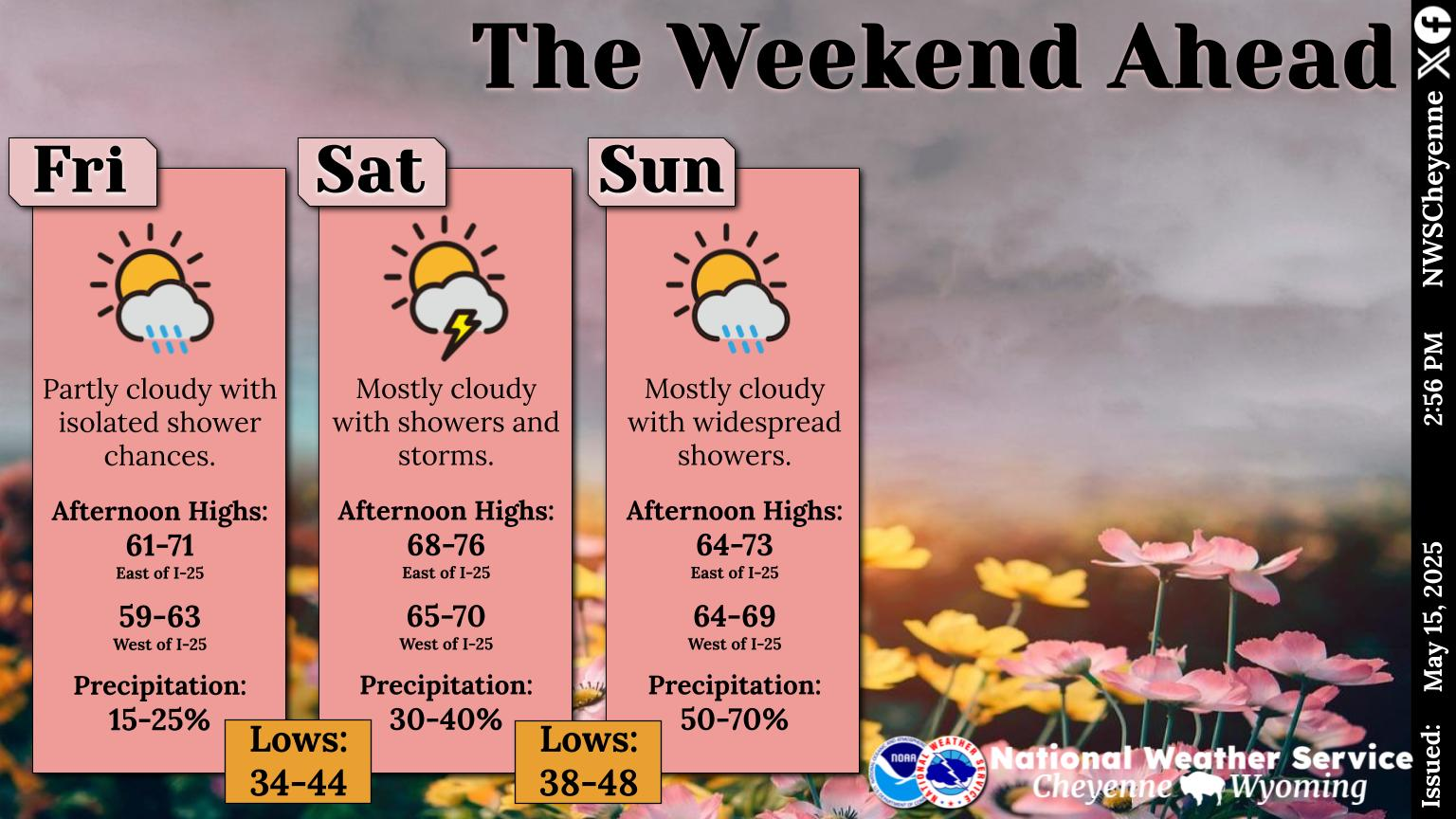
Storms, Rain Expected In SE Wyoming, Snow Possible In Mountains
The Cheyenne Office of the National Weather Service is predicting a weekend ahead for southeast Wyoming, with some snow possible above 10,000 feet.
The agency posted this statement on its website:
Showers and thunderstorms are expected Friday across southeast Wyoming and the Nebraska Panhandle. Strong outflow winds will be possible with storms in the afternoon. Saturday will be cooler with showers and storms continuing through the day across the region. Afternoon highs east of the Laramie Range will be mostly in the 60s, while points farther west will only reach the 50s. With these showers, portions of the Snowy Range above 10,000 feet elevation could even see snow mix in with rain. Looking ahead to the rest of the weekend will be much of the same. Near normal temperatures for early October continue into early next week with chances for precipitation. For the latest local forecast, be sure to check weather.gov/cys
Murals in Laramie
Gallery Credit: Adlynn Jamaludin, Townsquare Media Laramie
More From KOWB 1290


![Wyoming High School Football Week 5 Scoreboard: Sept. 29 – Oct. 3, 2022 [UPDATED]](http://townsquare.media/site/420/files/2019/10/RS6583_78034728-Thinkstock-FB-Scoreboard.jpg?w=980&q=75)