

Cheyenne, Laramie Could Get Two To Over Six Inches Of Snow
Forecasters with the Cheyenne office of the National Weather Service say that while they know a cold front is headed towards southeast Wyoming, they aren't certain at this point how much snow it will drop on the area.
The agency posted the following on it's website:
Cheyenne and Laramie each could get anywhere between two and over six inches of snow:
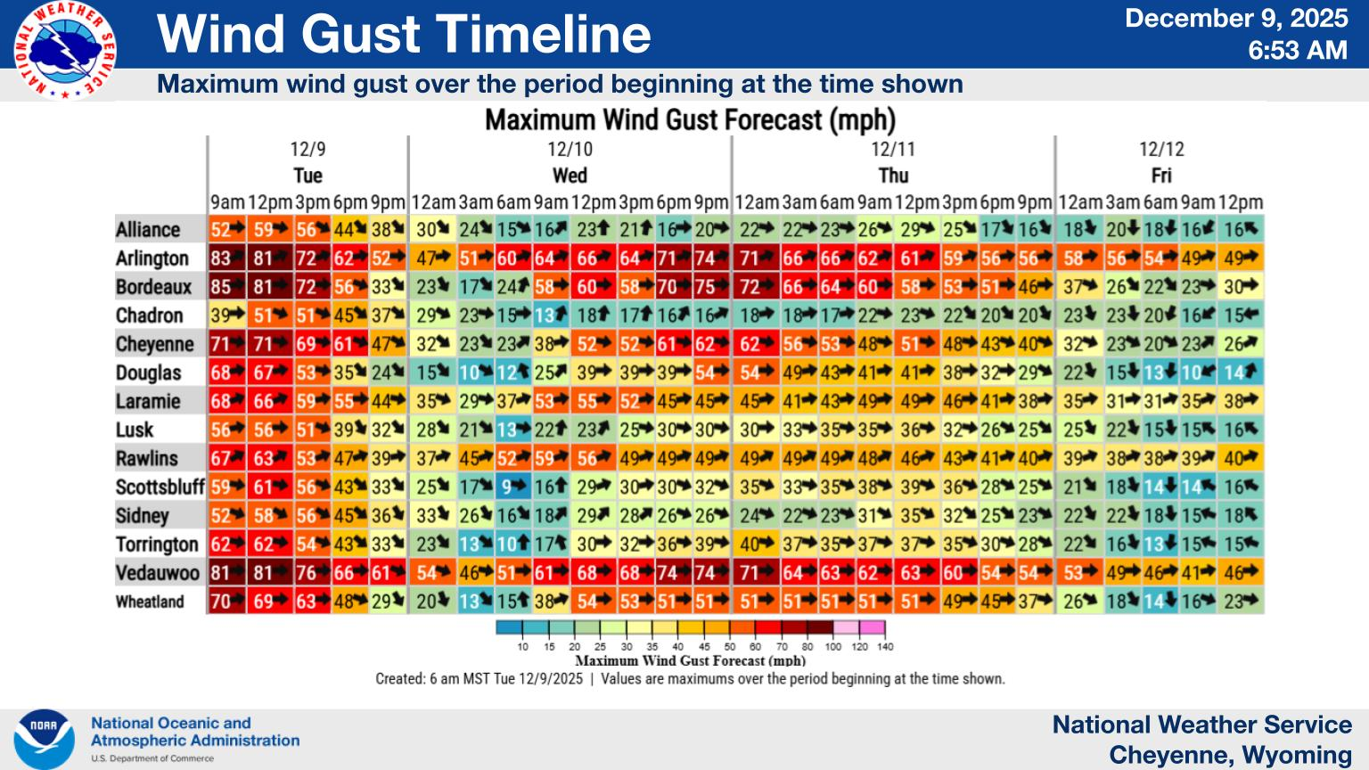
Here is a precipitation timeline:
Cheyenne, Laramie Forecasts
Cheyenne Forecast
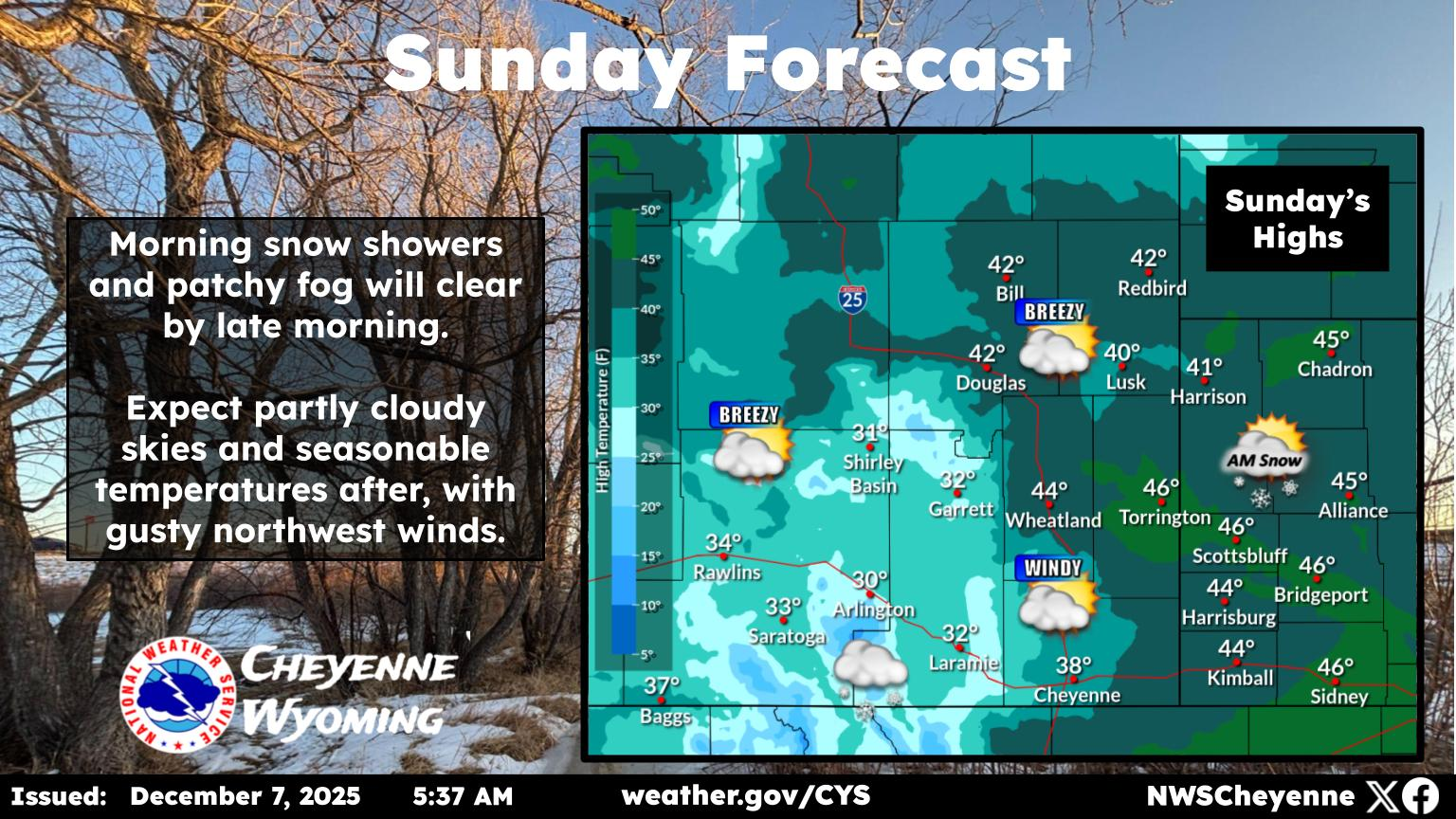
Today
Increasing clouds, with a high near 60. South wind 5 to 10 mph.
Tonight
A chance of rain before 8pm, then a chance of rain and snow between 8pm and 11pm, then snow after 11pm. Low around 25. Blustery, with a southwest wind 15 to 20 mph becoming north northwest after midnight. Winds could gust as high as 30 mph. Chance of precipitation is 80%. New snow accumulation of less than one inch possible.
Friday
Snow. Patchy blowing snow. High near 31. Blustery, with a north wind 20 to 25 mph, with gusts as high as 35 mph. Chance of precipitation is 80%. New snow accumulation of 1 to 3 inches possible.
Friday Night
A 30 percent chance of snow before 11pm. Patchy blowing snow before 11pm. Mostly cloudy, then gradually becoming mostly clear, with a low around 14. West northwest wind 10 to 15 mph, with gusts as high as 25 mph.
Saturday
Sunny, with a high near 43. West southwest wind 10 to 15 mph.
Saturday Night
Clear, with a low around 25.
Sunday
Sunny, with a high near 55.
Sunday Night
Mostly clear, with a low around 36.
Monday
Partly sunny, with a high near 62. Breezy.
Monday Night
Partly cloudy, with a low around 34.
Tuesday
A chance of showers. Partly sunny, with a high near 58. Breezy.
Tuesday Night
A chance of snow showers. Mostly cloudy, with a low around 21. Blustery.
Wednesday
A slight chance of snow showers. Mostly sunny, with a high near 47. Breezy.
Laramie Forecast
Today
A 30 percent chance of rain after 5pm. Increasing clouds, with a high near 51. West southwest wind 5 to 10 mph becoming northwest in the afternoon.
Tonight
Snow, mainly after 2am. Low around 25. North northwest wind around 10 mph. Chance of precipitation is 80%. New snow accumulation of 1 to 2 inches possible.
Friday
Snow. Patchy blowing snow after 11am. High near 30. North wind around 15 mph, with gusts as high as 25 mph. Chance of precipitation is 80%. New snow accumulation of 2 to 4 inches possible.
Friday Night
A 40 percent chance of snow before 11pm. Mostly cloudy, then gradually becoming mostly clear, with a low around 11. Wind chill values between zero and 5. North northwest wind 5 to 10 mph becoming west southwest after midnight.
Saturday
Sunny, with a high near 37. West southwest wind 10 to 15 mph.
Saturday Night
Mostly clear, with a low around 21.
Sunday
Sunny, with a high near 46.
Sunday Night
Mostly clear, with a low around 32.
Monday
Mostly sunny, with a high near 51. Breezy.
Monday Night
Mostly clear, with a low around 32.
Tuesday
A chance of snow showers. Mostly sunny, with a high near 48. Breezy.
Tuesday Night
A chance of snow showers. Partly cloudy, with a low around 21. Blustery.
Wednesday
A slight chance of snow showers. Mostly sunny, with a high near 38. Breezy.
Wyoming's Oldest Churches: From Prairie Tents to Steepled Landmarks
Gallery Credit: Wyoming State Archives, Historic Photograph Collection; Kolby Fedore