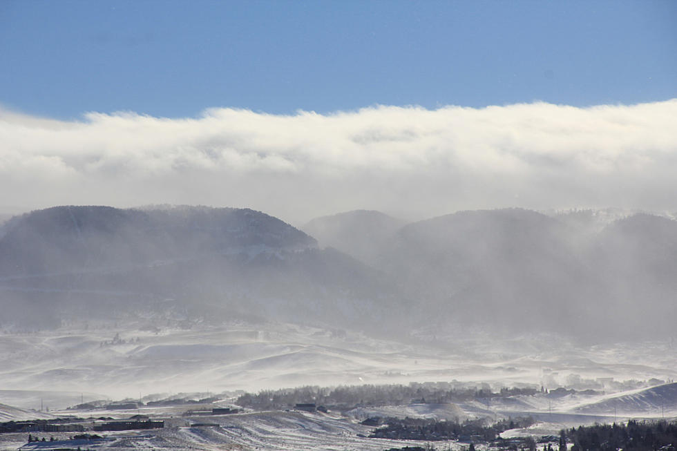
The Cheyenne Office of the National Weather Service is predicting varying amounts of snow and winds of up to 65 miles per hour across southeast Wyoming.

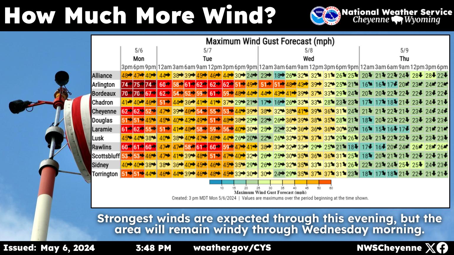
That's according to a post on the agency's Facebook page:

Here are your newest winter and wind headline updates! A Winter Storm Warning for the Sierra Madre Range is in effect, with the Snowys being under a Winter Weather Advisory. Additional areas of snowfall accumulation include portions of Carbon County where gusty winds will impact visibility. Peak timeline for snowfall accumulations will be tonight through Thursday morning. High Wind Warnings are also present for portions of the Interstate 80 corridor in the usual wind prone regions. Wind gusts up to 60-65mph are possible, with the strongest winds expected early Thursday through the afternoon hours. 

Cheyenne, Laramie Expecting More Snow This Weekend

Cheyenne Forecast:

Today
Partly sunny, with a high near 42. Windy, with a west wind 25 to 30 mph decreasing to 15 to 20 mph in the afternoon. Winds could gust as high as 40 mph.
Tonight
Partly cloudy, with a low around 19. West northwest wind 5 to 10 mph.
Friday
A 40 percent chance of snow, mainly after 7am. Partly sunny, with a high near 39. Northwest wind 5 to 10 mph.
Friday Night
Snow likely. Mostly cloudy, with a low around 16. North northwest wind 5 to 10 mph. Chance of precipitation is 60%. New snow accumulation of 1 to 2 inches possible.
Saturday
Snow likely. Mostly cloudy, with a high near 28. Northeast wind 5 to 10 mph. Chance of precipitation is 70%.
Saturday Night
A 50 percent chance of snow, mainly before 11pm. Mostly cloudy, with a low around 11.
Sunday
Sunny, with a high near 32.
Sunday Night
Partly cloudy, with a low around 14.
Monday
Mostly sunny, with a high near 39.
Monday Night
Partly cloudy, with a low around 18.
Tuesday
Mostly sunny, with a high near 41.
Tuesday Night
Partly cloudy, with a low around 18.
Wednesday
Mostly sunny, with a high near 41. Breezy.
Laramie Forecast:
Today
A 20 percent chance of snow before 8am. Areas of blowing snow. Partly sunny, with a high near 31. Windy, with a west wind 30 to 40 mph, with gusts as high as 55 mph.
Tonight
Patchy blowing snow before 8pm. Partly cloudy, with a low around 16. Breezy, with a west wind 15 to 20 mph decreasing to 10 to 15 mph after midnight.
Friday
A 40 percent chance of snow, mainly after 7am. Partly sunny, with a high near 29. West wind 10 to 15 mph.
Friday Night
Snow likely, mainly after 11pm. Mostly cloudy, with a low around 16. West northwest wind around 10 mph. Chance of precipitation is 60%. New snow accumulation of around an inch possible.
Saturday
Snow likely, mainly after 11am. Mostly cloudy, with a high near 21. Northeast wind 5 to 10 mph. Chance of precipitation is 70%.
Saturday Night
A 50 percent chance of snow before 11pm. Mostly cloudy, with a low around 8.
Sunday
Sunny, with a high near 22.
Sunday Night
Partly cloudy, with a low around 11.
Monday
Mostly sunny, with a high near 30. Breezy.
Monday Night
Partly cloudy, with a low around 17. Breezy.
Tuesday
Mostly sunny, with a high near 32. Breezy.
Tuesday Night
Partly cloudy, with a low around 17. Breezy.
Wednesday
Mostly sunny, with a high near 31. Breezy.

Top 10 Deadliest States for Highway Driving

A study using data from the National Highway Traffic Safety Administration from 2017 to 2021 determines which states have the highest rates of driver fatalities on freeways.

Gallery Credit: Kolby Fedore, Townsquare Media