
New Google Earth View Of Wyoming Is Mind-Blowing
Google Earth has gotten so much better over the years.
Their 3D images look much more realistic than they did when Google first came out with them.
Below is a video giving us a tour of Wyoming in 3D Google Earth.
Farther below is a quick guide on using today's more modern Google Earth to explore places like Wyoming.
There are still some odd problems.
Trees will lay flat on some mountainside and Google does not always know what to do with bridges.
Still, this is far better AI imaging than we have seen in the past.
This video feature is described as:
A tour through the spectacular mountainscape of the Wyoming Range of the Rocky Mountains in western Wyoming. Flying north to south and ending over the Wyoming Peak.
While not perfect it does give us an idea of what is on top of some mountains that we would never be able to visit in person, as well as what is down in the gaps and valleys below.
The video below is from 8 years ago. A lot of improvement has been made since then.
It's a tour of the most historic places in Wyoming.
Watch it and you'll see what I mean by, "we have come a long way".
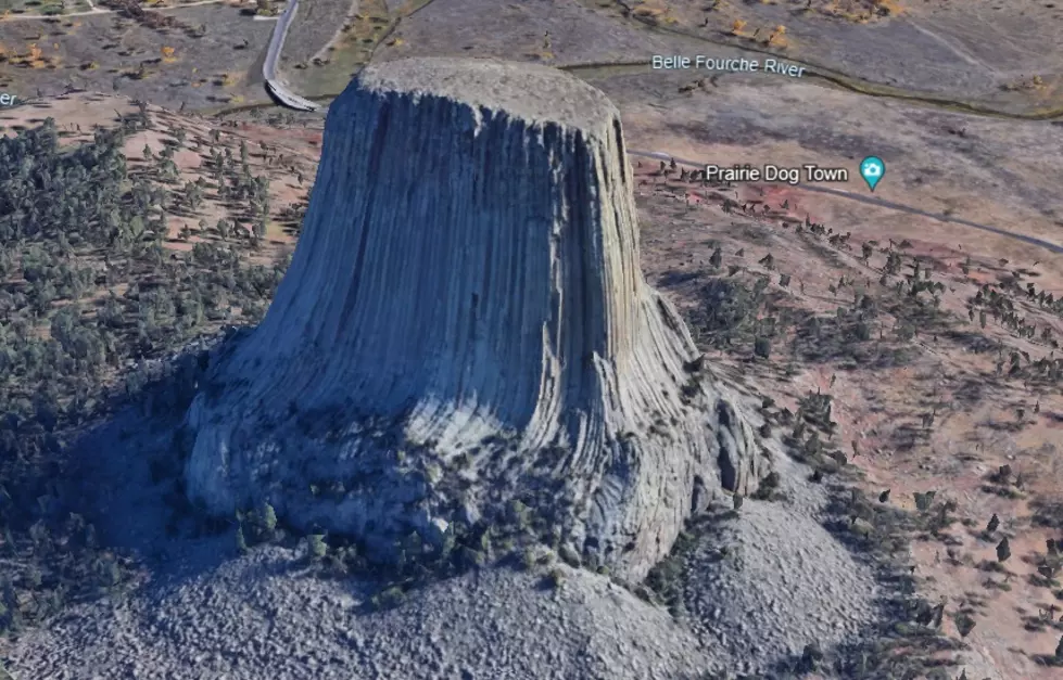
Try this link to see what Devil's Tower in Wyoming looks like on Google Earth today.
The more modern 3D effects of today's Google Earth are mind-blowing.
After clicking on that link try moving the picture around. It's a lot of fun.
Then click on the 3D option and watch what happens. WOW!
There are several ways to use Google Earth.
You can download it as an app.
You can just go to Google and type in what you want to see, followed by "Google Earth."
You can also download Google Earth onto your tower or laptop computer, which is what I do at home. It provides hours of entertainment and education.
SEE Inside Old Sheep Wagons Trick Out To Astound
Gallery Credit: Glenn Woods
Baby Bison In Thermopolis Wyoming
Gallery Credit: Glenn Woods