65 MPH Gusts Expected to Blast Portions of I-80 Tonight-Wednesday
Wind gusts up to 65 mph are expected to blast portions of Interstate 80 in southeast Wyoming tonight through Wednesday afternoon, according to the National Weather Service in Cheyenne.
High Wind Warnings are in effect for much of Carbon County from 9 p.m. this evening to 6 p.m. Wednesday.

URGENT - WEATHER MESSAGE
National Weather Service Cheyenne WY
203 AM MDT Tue Nov 1 2022

WYZ104-109-020000-
/O.CON.KCYS.HW.W.0046.221102T0300Z-221103T0000Z/
Ferris/Seminoe/Shirley Mountains-Central Carbon County-
Including the cities of Seminoe Dam and Rawlins
203 AM MDT Tue Nov 1 2022

...HIGH WIND WARNING REMAINS IN EFFECT FROM 9 PM THIS EVENING TO
6 PM MDT WEDNESDAY...

* WHAT...Southwest winds 30 to 40 mph with gusts up to 60 mph
  expected.

* WHERE...Ferris/Seminoe/Shirley Mountains and Central Carbon
  County.

* WHEN...From 9 PM Tuesday to 6 PM MDT Wednesday.

* IMPACTS...Mainly to transportation. Strong cross winds could
  be hazardous to light weight and high profile vehicles,
  including campers and tractor trailers.

PRECAUTIONARY/PREPAREDNESS ACTIONS...

A High Wind Warning means a hazardous high wind event is expected
or occurring. Sustained wind speeds of at least 40 mph or gusts of
58 mph or more can lead to property damage.
URGENT - WEATHER MESSAGE
National Weather Service Cheyenne WY
203 AM MDT Tue Nov 1 2022

WYZ110-113-020000-
/O.CON.KCYS.HW.W.0046.221102T0700Z-221103T0000Z/
North Snowy Range Foothills-Upper North Platte River Basin-
Including the cities of Arlington, Elk Mountain, Saratoga,
and Encampment
203 AM MDT Tue Nov 1 2022

...HIGH WIND WARNING REMAINS IN EFFECT FROM 1 AM TO 6 PM MDT
WEDNESDAY...

* WHAT...Southwest winds 30 to 40 mph with gusts up to 65 mph
  expected.

* WHERE...North Snowy Range Foothills and Upper North Platte
  River Basin.

* WHEN...From 1 AM to 6 PM MDT Wednesday.

* IMPACTS...Mainly to transportation. Strong cross winds could
  be hazardous to light weight and high profile vehicles,
  including campers and tractor trailers.

PRECAUTIONARY/PREPAREDNESS ACTIONS...

A High Wind Warning means a hazardous high wind event is expected
or occurring. Sustained wind speeds of at least 40 mph or gusts of
58 mph or more can lead to property damage.
URGENT - WEATHER MESSAGE
National Weather Service Cheyenne WY
203 AM MDT Tue Nov 1 2022

WYZ111-020000-
/O.UPG.KCYS.HW.A.0046.221102T1500Z-221103T0000Z/
/O.EXB.KCYS.HW.W.0046.221102T1500Z-221103T0000Z/
Southwest Carbon County-
Including the city of Baggs
203 AM MDT Tue Nov 1 2022

...HIGH WIND WARNING IN EFFECT FROM 9 AM TO 6 PM MDT WEDNESDAY...

* WHAT...Southwest winds 30 to 40 mph with gusts up to 60 mph
  expected.

* WHERE...Southwest Carbon County.

* WHEN...From 9 AM to 6 PM MDT Wednesday.

* IMPACTS...Mainly to transportation. Strong cross winds could
  be hazardous to light weight and high profile vehicles,
  including campers and tractor trailers.

PRECAUTIONARY/PREPAREDNESS ACTIONS...

A High Wind Warning means a hazardous high wind event is expected
or occurring. Sustained wind speeds of at least 40 mph or gusts of
58 mph or more can lead to property damage.
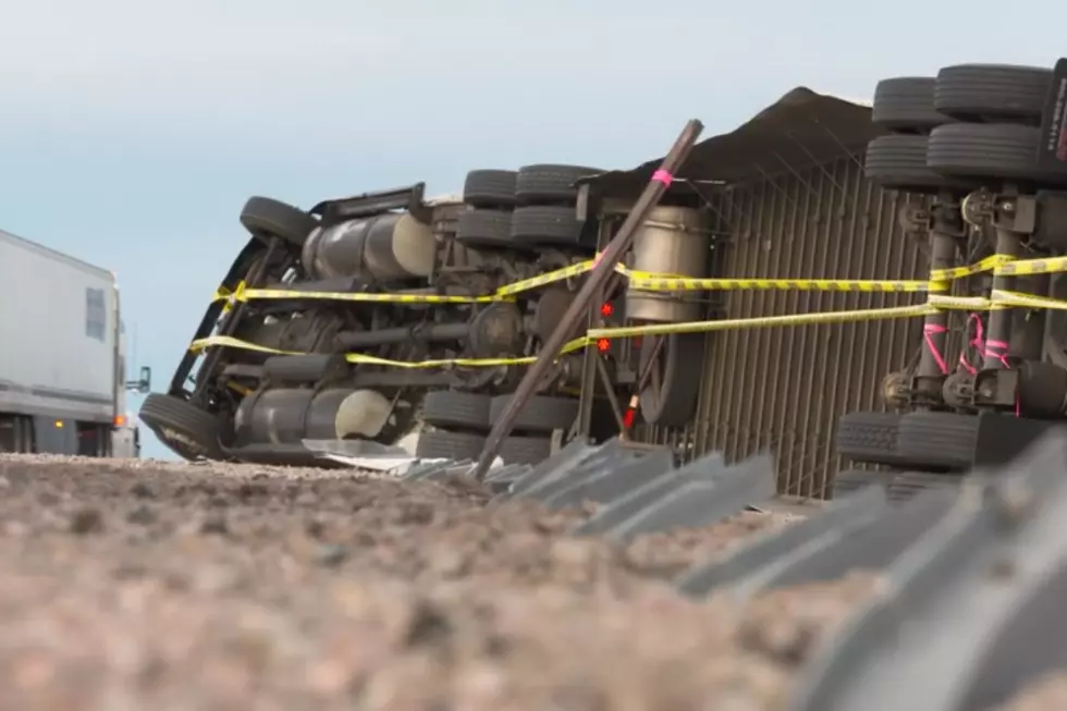
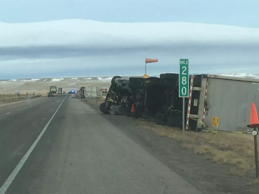
The NWS says strong crosswinds could be hazardous to lightweight and high-profile vehicles, including campers and semis.
Drivers are encouraged to call 511 or go to wyoroad.info for the latest road closures and advisories.

6:30 AM November 1st - High Wind Warnings are in effect for much of Carbon County in Wyoming starting Tuesday night and continuing through Wednesday afternoon. Wind gusts up to 65 MPH are possible along portions of I-80 between Arlington and Rawlins. Use caution if traveling with light weight or high profile vehicles, including campers and tractor trailers.
Here's What Wyomingites REALLY Think About The Wind
More From KOWB 1290