
![Laramie River Substantially Higher Than Normal [PHOTO UPDATE]](http://townsquare.media/site/106/files/2011/05/Laramie-River-3.jpg?w=980&q=75)
Laramie River Substantially Higher Than Normal [PHOTO UPDATE]
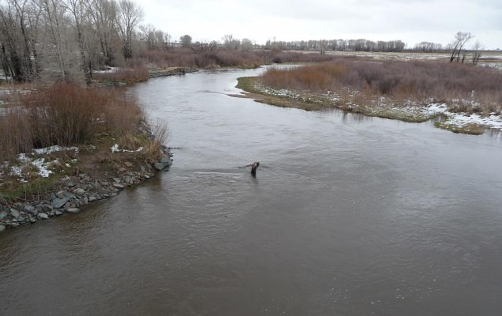
This morning I headed out to take a look at the water levels on the Big Laramie River; compared to our last set of photos about two weeks ago, water levels have risen substantially. This morning's batch of photos are generally taken in many of the same places as our previous pictures so you can easilly see the difference in water levels. This becomes especially apparent when you look at the pictures of the Laramie River running under the Snowy Range Road bridge below.
The City of Laramie has also now set up barrackades along the trail entrances to Green Belt Park warning of danger due to high waters and flash floods. As of May 20th Greenbely Park is officially closed. If you are looking for alternatives to g out and enjoy a the outdoors in Laramie check out our full listing of Laramie Parks. In West Laramie the city has actually built a small dike across the trail's entrance in an attempt to prevent flooding in low lying West Laramie homes. The whole time I was looking at this dike the big question that kept running across my mind was, aren't flood waters just going to was away this loose dirt? Take a look at the pictures and see if you agree. One of our previous stories eplained why the city wasn't filling sandbags yet, which would be much more effective. As you can see from this round of pictures there is a sand pile in West Laramie ready for the purpose of sand bagging if needed. Either way you have to be a little concerned if your property is along the river. Earlier we spoke with C & A Pet & Livestock Supply which is located right along the river, and they seemed a little nervous but had good plans in place to deal with the flooding. Only time will tell what happens now as the river reaches it's highest levels of the spring in the next 2-3 weeks. Check back often for the most up to date exclusive coverage of the situation.
More From KOWB 1290


![Homecoming Parade 2018 [PHOTOS]](http://townsquare.media/site/245/files/2018/10/IMG_3298.jpg?w=980&q=75)