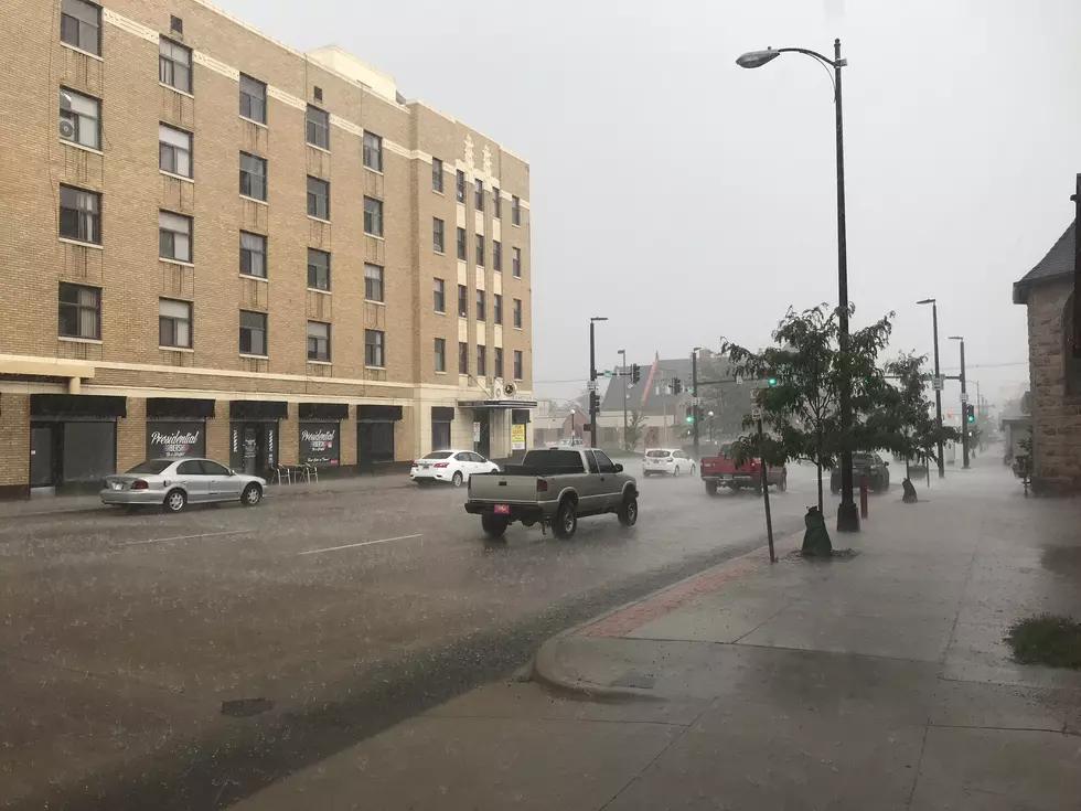
It looks like rain and more rain may be headed for southeast Wyoming through Monday, according to the Cheyenne Office of the National Weather Service.

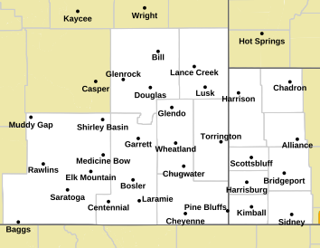
A flash flood watch is in effect for virtually the entire region through the weekend according to the National Weather Service  [shown in green]:

Map of Forecast Area

The weather service posted the following predictions for rain for Cheyenne, Laramie and several other communities in southeast Wyoming and the Nebraska Panhandle:

More rain is on the way! Showers and thunderstorms will be returning today. Areas that receive multiple rounds (or training) thunderstorms, there is a risk of experiencing flash flooding. Never drive through flooded roadways. Turn around, don't drown. Stay tuned!

Here is the Cheyenne forecast:

Today
A chance of showers and thunderstorms, then showers likely and possibly a thunderstorm after noon. Some of the storms could produce heavy rain. Partly sunny, with a high near 67. North wind 5 to 15 mph becoming south in the afternoon. Chance of precipitation is 70%. New rainfall amounts of less than a tenth of an inch, except higher amounts possible in thunderstorms.
Tonight
A chance of showers and thunderstorms before 3am, then a slight chance of showers. Some of the storms could produce heavy rain. Mostly cloudy, with a low around 48. Southwest wind 5 to 15 mph becoming northwest after midnight. Chance of precipitation is 40%.
Saturday
A chance of showers before 9am, then a chance of showers and thunderstorms between 9am and noon, then showers and possibly a thunderstorm after noon. Some of the storms could produce heavy rain. High near 59. North northwest wind 5 to 15 mph becoming southeast in the afternoon. Chance of precipitation is 90%.
Saturday Night
Showers and possibly a thunderstorm before midnight, then a chance of showers and thunderstorms between midnight and 3am, then a chance of showers after 3am. Some of the storms could produce heavy rain. Low around 49. Southeast wind 5 to 15 mph. Chance of precipitation is 80%.
Sunday
A chance of showers before 9am, then a chance of showers and thunderstorms between 9am and noon, then showers and possibly a thunderstorm after noon. High near 65. Southeast wind 5 to 15 mph. Chance of precipitation is 80%.
Sunday Night
A chance of showers and thunderstorms before 3am, then a slight chance of showers. Mostly cloudy, with a low around 50. Chance of precipitation is 50%.
Monday
A slight chance of rain and thunderstorms before 9am, then a slight chance of rain between 9am and noon, then rain likely and possibly a thunderstorm after noon. Mostly cloudy, with a high near 68. Chance of precipitation is 70%.
Monday Night
A chance of rain and thunderstorms before midnight. Mostly cloudy, with a low around 49.
Tuesday
A chance of rain and thunderstorms after noon. Mostly sunny, with a high near 71.
Tuesday Night
A chance of rain and thunderstorms before midnight. Mostly cloudy, with a low around 50.
Wednesday
Rain likely and possibly a thunderstorm. Partly sunny, with a high near 72.
Wednesday Night
A chance of rain and thunderstorms. Mostly cloudy, with a low around 51.
Thursday
Rain likely and possibly a thunderstorm. Mostly sunny, with a high near 73.
Here is the forecast for Laramie:
Today
A chance of showers and thunderstorms, then showers and possibly a thunderstorm after noon. Some of the storms could produce heavy rain. High near 55. West northwest wind 10 to 15 mph becoming south southeast in the morning. Chance of precipitation is 80%. New rainfall amounts between a tenth and quarter of an inch, except higher amounts possible in thunderstorms.
Tonight
A chance of showers and thunderstorms. Some of the storms could produce heavy rain. Mostly cloudy, with a low around 41. West southwest wind 10 to 15 mph. Chance of precipitation is 40%.
Saturday
A chance of showers, then showers and possibly a thunderstorm after noon. Some of the storms could produce heavy rain. High near 53. West wind around 10 mph becoming east southeast in the afternoon. Chance of precipitation is 90%.
Saturday Night
Showers and possibly a thunderstorm before midnight, then a chance of showers and thunderstorms between midnight and 3am, then a chance of showers after 3am. Some of the storms could produce heavy rain. Low around 43. East wind 5 to 10 mph becoming south after midnight. Chance of precipitation is 80%.
Sunday
A chance of showers, then showers and possibly a thunderstorm after noon. High near 56. Southeast wind 10 to 15 mph. Chance of precipitation is 90%.
Sunday Night
A 40 percent chance of showers and thunderstorms before midnight. Mostly cloudy, with a low around 47.
Monday
A slight chance of rain, then rain and possibly a thunderstorm after noon. High near 60. Breezy. Chance of precipitation is 80%.
Monday Night
A chance of rain and thunderstorms before midnight. Mostly cloudy, with a low around 48. Breezy.
Tuesday
Rain likely and possibly a thunderstorm after noon. Mostly sunny, with a high near 63. Breezy.
Tuesday Night
A chance of rain and thunderstorms before midnight. Mostly cloudy, with a low around 47. Breezy.
Wednesday
Rain and possibly a thunderstorm. Partly sunny, with a high near 63.
Wednesday Night
A chance of rain and thunderstorms. Mostly cloudy, with a low around 48.
Thursday
Rain likely and possibly a thunderstorm. Partly sunny, with a high near 63.